Training 19th Apr

Riders John & Andrew
Distance 72.97 mi
Time 6h02m33s
Average Speed 12.08 mph
Ascent 1473 m
Run.GPS Training Profile

As planned we went out for a good training run on Sunday. The weather was cool and cloudy to start with but it soon brightened up to a lovely afternoon with a northerly breeze. It was hard to decide whether it was jacket on or off weather as the wind did have a chilly bite.

We met in Long Crendon and headed south through Thame town centre and out along the B4445 to Chinnor. Pretty uneventful cycling with the Chiltern ‘mountains’ directly ahead of us. We crossed the Ridgeway and then needed to climb up Chinnor Hill, a pretty steep and steady climb to gain 200 m (600 ft) of altitude. We declined the turning along Bledlow Ridge and headed to the more minor road through Crowell Hill and Radnage. This single-track road seemed to attract a number of cars as we descended steadily towards West Wycombe.

We climbed back up the adjacent valley to Saunderton. We stopped briefly at the bottom of what looked like a minor hill on Small Dean Lane, its looks were deceiving. It was short but boy was it steep, we reckon that was probably the steepest hill we have encountered whilst training. From the map I’ve calculated it as 1:5 and it was a job keeping the front wheel down! From the top we had an undulating ride to Speen which had a steep hairpin approach.

After the climbing it was a gentle descent into Great Missenden and a coffee-stop at the caf

Training Schedule

Not long to go now and with Easter out of the way it’s time to schedule the training in the next few weeks. As well as commuting as often as possible we have the following training planned.

This Saturday we plan to do a 70 mile circular ride in the Chilterns. The following weekend will be our shakedown test run where we go fully laden and camp somewhere and cycle back the following day, full LEJOG distance each way. No plans for the following weekend but the Isle of Wight Randonnee looks tempting! John has been invited to do the Classic Oxfordshire ride on 10th May with some colleagues from work which he might do as well.

Then it’ll be time to LEJOG!

Training 4th Apr

Riders John
Distance 33.74 mi
Time 2h20m19s
Average Speed 14.43 mph
Ascent 262 m
Run.GPS Training Profile

Only John was able to go out training this weekend and he did a short half-day ride on Saturday afternoon. It was a very pleasant day but with a teasing brisk westerly wind.

The route climbed up to the NCN route to Wantage from East Hendred. This uses very minor roads and/or farm tracks and is quiet and the surface is generally good and surfaced. After Cycling through the centre of Wantage the bridleway from East Challow to Childrey was used to cut off a stretch along the B4507. This track is narrow but surfaced and is a useful little cut through.

Sticking to minor roads through Sparsholt and Westcot John had to briefly join the B-road to get to Kingston Lisle and the steep descent back into the Vale of White Horse. Familiar roads followed to Goosey, Charney Bassett, Lyford and the Hanneys. This area is very flat and with a tail wind the pace was pretty speedy. Finally the long, straight, boring road to Steventon and on to Drayton and home.

An easy ride just to keep the legs from seizing up.

Andrew and John went to Evan’s Cycles in Milton Keynes on Sunday to top up on equipment. They had a very poor selection of panniers which John wanted to look at but they both came away with a few essentials. We think we have most equipment sussed now and are aiming to put it all to the test later in April on a training run.

But I would cycle 1000 miles

No joint training ride this week. John was in Portugal for a long weekend but Andrew did a 60-mile ride near Salisbury on his racing bike.

In other news, Tom has decided to step down from the challenge. He hasn’t been able to do as much training and has felt it would be better if he didn’t try the LEJOG at this time.

Here is the potential route for the final few days of the trip. After eleven days cycling we should be in the vicinity of Loch Lomond. We’ll head westwards up Glen Croe to Rest and be thankful (I think we will be!) before descending alongside Loch Fynne to Inveraray. The A819 and A85 will take us through the Pass of Brander to Connel for an overnight stop near Loch Creran.

Day 13 starts alongside Loch Linnhe all the way to Fort William. We’ll try and cycle as much of the Great Glen Cycle Route to Fort Augustus as possible. The route uses minor roads, forest tracks and the Caledonian Canal towpath to avoid the busy A82. We’ll avoid the worst of the forest track sections though which will mean using the A82.

We’re going to avoid the A82 alongside Loch Ness on Day 14 as it is busy with tourist traffic and not pleasant to cycle along. We’ll climb on the B862 on the east bank of the loch down into Foyers and alongside the loch to Inverness. Using the NCN 1 to get us across the Moray Firth we’ll use minor roads alongside Beauly Firth to get to Muir of Ord. From here we turn north through Dingwall before using minor and B-raods past Alness and a planned stop at Bonar Bridge.

From Bonar Bridge the route is north past Lairg into the wilderness of central northern Scotland. At Altnaharra we can either continue north to Tongue or take the slightly shorter route via the B873 to Bettyhill. Quite a short day this, it will probably be the shortest cycling day. The final day is also quite short and will use the NCN 1 route to Thurso and John o’ Groats. This route uses mostly minor roads and avoids the A836 as much as possible. We’ll probably have time for a diversion to Dunnet Head (the most northerly point in mainland Britain). After celebrating the finish I’m sure we’ll head out to the lighthouse at Duncansby Head to complete the trip from SW to NE.

We’ll probably camp at John o’ Groats before the short journey to Wick to arrange travel back home.

So, that’s the plan, I’m sure we’ll modify it as we go but we think it’s a good idea to have a general route in mind before we set off. It’ll be interesting to see how close we stick to it!

Eight to eleven

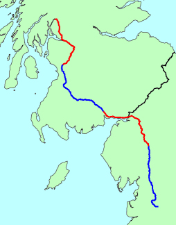
Due to Mothering Sunday and other commitments there was no formal training ride this weekend. Just commuting miles in the interim to keep the fitness going.

Here, however, is the next batch of route information. After day seven we should be staying somewhere around Clitheroe where we leave for day eight through the Forest of Bowland and over Catlow Fell to Kirkby Lonsdale. Heading almost due north all day we follow the River Lune valley through the spectacular gap at Tebay. John will stop to admire the geology which he mapped and drew for his first degree. Over the fells and down into the Eden Valley for a planned stop near Temple Sowerby a few miles from Penrith.

Day nine should see us following the Eden valley northwards to the west of Carlisle before we turn east to Gretna. Crossing into Scotland we’ll follow the Solway Firth to Annan and Dumfries. This will be one of the flattest days on the whole trip with no major climbs.

The next day has given John the most difficulty. There are several routes for getting through central Scotland on a LEJOG. You can follow the M74 on the old road and go between Glasgow and Edinburgh and head towards Stirling. The A76 route is sometimes done but this is an unpleasant and dangerous road. Many LEJOGgers head across to Arran from Ardrossan and on to the Mull of Kintyre. The route John has chosen uses advice from the CTC forums about suitable cycling roads. From Dumfries the route will be B729, A702, B729, A713, B730, B751. This takes us west of Ayr and east of Kilmarnock on quieter roads, there’s little potential for using minor roads in this area. But the roads follow the valleys so hopefully it shouldn’t be too hilly. We’ll aim to camp somewhere near Kilmaurs.

The eleventh day aims to go through Glasgow. The old A77 alongside the new M77 is apparently almost deserted now so we’ll use that to get into Glasgow. We’ll pick up the NCN routes from here. NCN 7 crosses the Clyde via Bell’s Bridge and then follows an old railway route to Dumbarton. From here it goes alongside the River Leven northwards to Balloch. From here we’ll pick up the NCN 40 path alongside the west bank of Loch Lomond all the way to Arrochar and an overnight stop. This should be an interesting day of contrasts. Navigating through the centre of Glasgow followed by riverside and lochside offroad routes. Has the potential to be the highlight day of the trip.

Reproduced from Ordnance Survey map data by permission of the Ordnance Survey

Training 15th Mar

Riders John & Andrew
Distance 82.13 mi
Time 6h04m17s
Average Speed 12.78 mph
Ascent 1304 m
Run.GPS Training Profile

Longest training ride so far. The route was based closely upon that used by the Squires and Spires Cyclosportive which stars in Naseby. We started in Cropredy (famous for its music festival) near Banbury and went clockwise, the sportive goes anticlockwise. We had arranged to meet John’s brother at Catthorpe at 10.30am which was about 30 miles from the start. We set off at 8am.

The ride was almost exclusively on minor roads through Claydon, Priors Hardwick, Priors Marston and Napton-on-the-Hill. Pretty flat as well as we followed the Oxford Canal which we crossed several times. A small climb up to Napton where we had a short cycle on the A425 which was very quiet on a Sunday morning. We turned through Grandborough and Willoughby, again on small lanes until we got to Barby and Kilsby.

We had a short section on the A5 over Kilsby tunnel with its impressive castellated towers before we turned toards the pretty village of Crick. Yelvertoft and Lilbourne were next before we arrived at the Manor Farm teashop in Catthorpe. An excellent stopping place nestled between the M1 and M6, if you are heading south on the M1 or M6 it’s well worth the short diversion rather than head for the motorway services.

We had a coffee, cake and a chat before the now three of us headed to Stanford Hall and a lovely ride through the parkland. A moderate climb up to Cold Ashby followed where John was excited to see the triangulation pillar where the triangulation of Britain started, it has a plaque to mark the occasion but was in a field of young crops, so John left his camera in his bag on this occasion!

After Naseby there was more parkland at Cottesbrooke next with a lovely descent down a gated road with no hedges or fences. We set about looking for a lunch stop but Creaton and Hollowell disappointed. We tried the gardens at Coton but they are shut until 31st March. We found a pub in Ravensthorpe which only did Sunday roasts. We stopped for a drink and a packet of crisps before heading south.

John’s brother peeled off to make his way home shortly after Ravensthorpe and the two remaining riders continued south through the Bringtons to Flore and Weedon Bec. After picking up sandwiches at a garage we quickly left the grimness of Weedon and found a bench (with funeral wreath) on the hill to Farthingstone where we stopped for sustenance.

The next section was undulating to Maidford, Adstone, Canons Ashby and Moreton Pinkney. We were getting quite tired by this point and it was nice to finish on a small lane from Culworth by the River Cherwell. I was almost all downhill on the A361 to the turning to Cropredy where we were able to freewheel all the way back to the car.

A pretty ride, the last ten miles were quite tough and to be honest we weren’t looking at the scenery much by then! We reckon 65 miles fully laden is about right for a daily target.

On the 7th day

Map of the first 7 days
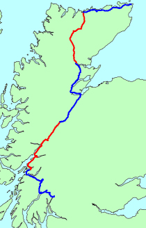
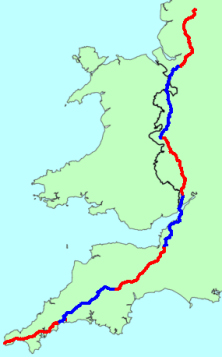
John has been putting some time into working out the route. The rough itinerary can be seen on The Plan and this will change as he works out exactly where we should be ending up each evening.

This is a map of the first seven days probable route. Day one starts in Land’s End (dur) and is borrowed extensively from a route used by some Cornish men who did the LEJOG a few years ago, utilising their local knowledge to avoid the worst hills (allegedly). It heads via Penzance and south of Truro over the King Harry ferry across the River Fal. Using minor roads nearly all the way we should end up in St Austell or Lostwithiel.

Day two also uses the route used by the aforementioned Cornish men and looks like it could be a highlight day. It heads to Okehampton using an old railway line at times skirting around the north of Dartmoor. The planned stop is somewhere near Cheriton Bishop.

The third day is John’s own route. This might get tweaked. Again mostly minor roads via Crediton, Cullompton and Wellington. It slips past the northern outskirts of Taunton to end up near Bridgwater or Burnham-on-Sea.

This should set us up nicely for the assault on the Bristol area and the Severn Estuary. This is mostly the CTC YHA route from Street and heads parallel to the M5 to Avonmouth. Using the M5 bridge to cross the River Avon (there is a cycle path!). We have a second motorway bridge, the old Severn Bridge on the M48 to get to Chepstow. Probable route is then via Tintern Abbey to end up close to Monmouth or the Forest of Dean.

The Wye Valley is one of the highlights of a LEJOG and that will be our fifth day. Heading to Symonds Yat and Ross-on-Wye we follow the river past Hereford and then the River Lugg to Leominster. Our stop will be close to Clun.

The sixth day will be the longest so far, nearly 80 miles. We need to get in a position to get between Manchester and Liverpool in one day with the tricky navigation and busier roads. From Clun the route is nearly due north all the way past Shrewsbury, Ellesmere, Wrexham and Chester. We’ll aim to camp near the Delamere Forest close to Northwich.

The bit through the northwest is usually one of the lowlights of a LEJOG and most people just get it done as quickly as possible. Our route leaves us plenty of time to get through but it’s hard to avoid main roads and towns. Avoiding Warrington it goes via Lymm, Leigh, near Bolton and through Chorley. It squeezes between Preston and Blackburn before finishing at Clitheroe. Could be a tough day, 68 miles and a nightmare for navigation.

So that’s the first seven days sussed (maybe). Now, how do we get past Glasgow in one go?

Reproduced from Ordnance Survey map data by permission of the Ordnance Survey

We have liftoff

Launched the website yesterday with around 10 weeks to go to the off. Hopefully everything works OK, but there’s still time to tweak! A big thanks to Redsmartie for doing the banner for us, we think it looks really cool.

The Justgiving pages are all set up and a massive thanks to everyone who is donating, it’s very generous of you to support our little quest. Slightly concerning how everyone thinks we’re a little mad and the sharp intakes of breath when we say we’re doing it fully laden!

Training 7th Mar

Riders John & Andrew
Distance 67.50 mi
Time 5h40m47s
Average Speed 11.88 mph
Ascent 1328 m
Run.GPS Training Profile

This route was adapted from the Highclere Castle Route77Cat sportive route used in 2008 and to be used again in June 2009. Instead of starting at Highclere Castle though we met up at the carpark near Combe Gibbet on Walbury Hill, the highest point in Berkshire.

We headed south through Combe and Faccombe where there was a fantastic swervy descent on a smooth road through woodland. A real rush. After Hurstbourne Tarrant we joined the B3048 initially alongside the Bourne Rivulet and then the River Test at Longparish. Despite the B-road status it was pretty quiet. The scenery was pretty with the clear river close by, the altitude was worrying descending to rather low values and we made quick progress. After Wherwell we rejoined minor raods to Stockbridge and the lowest point on the ride, just 35m above sea level.

We picked up the B3049 for the ascent up to Stockbridge Down and a tea stop. We turned off through Crawley and across the A34 at Worthy Down. We had a rather dull road alongside the A34 next, it was busy and undulating to South Wonston and it was a relief to pick up the lanes to Wonston again. We decided to divert off the route to get to Whitchurch for lunch where we spent about 15mins looking for a good place to eat. The Silk Mill is missing a trick with its tea-room as you have to pay to get into the mill to get to the tea-room. With virtually no competition in the town I’m sure it would pick up passing trade for a spot of lunch or a tea and cake. In the end we bought filled rolls at the bakery and ate them by the river.

Heading north out of Whitchurch we headed back to the planned route, this involved a rather steady climb all the way to the B3051 and onwards to the top of White Hill near Watership Down. With fantastic views ahead we zoomed down the descent only to find we had to regain nearly all of the lost altitude up Isle Hill to Sydmonton.

The final ten miles was all on minor roads but was fairly hard work with several minor ascents through Burghclere, Woolton Hill and Ball Hill (the clue is in the name of the latter two!). We knew we had the massive hill back to the cars at the end of the ride and we braced ourselves. It’s a double whammy as you get to the top only to go straight back down and have to climb up again! It has a couple of very steep sections which we stopped for a breather on. It was a relief to get back to the cars without having to get off and push!

A good route, a couple of dull sections and Whitchurch isn’t the most exciting town in the world. A tough finish after 60-odd miles as well. I’m sure the sportive event that uses most of this route is a good test.

Training 22nd Feb

Riders John & Andrew
Distance 66.76 mi
Time 5h45m44s
Average Speed 11.59 mph
Ascent 1281 m
Run.GPS Training Profile

This was our longest and hilliest training ride so far and should be much more typical of a LEJOG day although we were basically unladen on this ride. The weather was pleasant despite a stiffish breeze at times.

We met up in Burford where the town and carpark were deserted at 8.30am on a Sunday morning. We were heading to Cheltenham and back, basically crossing the Cotswolds twice and dropping down off of the escarpment. The ride was almost entirely based upon one submitted to the CTC Maps site.

We followed the Windrush valley on very minor roads to the village of Windrush and onwards to Sherborne and Farmington. The route was undulating with very little in the way of flat to get a rhythm going but we were steadily climbing all the way to the top of the scarp slope overlooking Cheltenham. The roads were really tiny and we saw zero traffic and we were surrounded by beautiful Cotswold scenery.

We decided against cycling the A40 at Andoversford as the CTC route suggested and went across the A436 to the top of Ham Hill. The hill was steep and the road was covered in grit so we took it as carefully as we could until we got to the outskirts of Cheltenham, we didn’t plan on entering the town so we skirted through Charlton Kings to begin the ascent back up the scarp. We did this via Leckhampton Hill which was a steep and steady climb for a couple of miles. A steady rhythm was all that was required though. The road was the busiest we had encountered though and many times we had cars crawling behind us waiting for a safe opportunity to pass.

We had to endure a section of the A417 next (there might be a way to avoid this to get to Birdlip but we weren’t sure). This was also uphill and the road was wide and fast and smelt of oil and diesel as we pedalled hard. Not the nicest road ever. We soon turned off into Birdlip though and were back onto tiny roads.

This return section was fantastic, small Cotswold villages tucked into the hillsides looked like model villages as we approached and unchanged for hundreds of years. It really was a hidden world. There was a very very steep climb out of Caudle Green though which we both agreed would have been very tough to pedal up fully laden.

After the climb there was an amazing stretch along a valley with a stream to one side. The highlight village was Daglingworth which was stunningly beautiful and just a few miles from Cirencester where we stopped for lunch. After eating we headed north to get back to Burford with another lovely stretch along the Coln valley and onwards through the hoards of tourists in Bibury.

A few more villages past by as the landscape changed from the hills to much more open farmland and the only real flat section of the ride. We were soon back in Burford where our tired legs were ready for a break after 1.5km of ascent! A truly lovely ride and I would highly recommend the route to any cyclist.